

-
Recent Status Updates
-
 I see Lamb80782 had the same remove the driver seat as I am having.· 0 replies
I didn't see the ulitmate solution. I think removing "stop" would be the solution but am unable to see very well under the seat. Has anyone come up with the solution?
I also am reoving to have re-uphostered. Itried removing the black access cover but it is very tight under there and not enough room for a regular wrench. May try a 1/4 rachet drive.
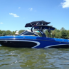
https://photos.app.goo.gl/S37erPn8an8fDkHBA of seat.
-
 Good morning. I saw you talked about replacing the ram fill valves. I have a 2021 ri237 with a broken valve It’s under warranty but dealer is going to be very slow to fix it. Which wiring harness do I need to make sure I have when I order off of Amazon. Thank you scott· 0 replies
-

-
 I see you have the Go Surf assist installed on your 2008 Enzo SV230. I am about to do the same thing on my 2007 Enzo SV240. Do you happen to have some photos of the install taken from the transom? And how did you notch out the spacers for the bump out in the swim platform bracket?· 0 replies
Thanks
-
 Hey @chowder2016 looking at a used Ri257 at Mello's.. Any feedback you can provide before i commit ? :-)· 0 replies
-
-
-
Topics
-
-
Popular Contributors
Nobody has received reputation this week.